
Cyclone Freddy in March 2023 was a stark reminder of Malawi's vulnerability to extreme weather events. Blantyre, Lilongwe, and Zomba experienced severe flooding, affecting hundreds of thousands of residents and causing extensive infrastructure damage. As Malawi's cities continue to expand, the question isn't whether another major flood will occur, but when – and whether we'll be prepared.
The Challenge: Rapid Urbanization Meets Climate Change
Malawi's urban population is growing at 4.2% annually, among the fastest rates in Africa. This growth is largely unplanned, with informal settlements expanding into floodplains, wetlands, and steep slopes where drainage is poor and exposure to climate hazards is high.
Simultaneously, climate change is intensifying rainfall events. What was historically a "1-in-50-year" flood may now occur every 20-30 years, catching infrastructure design standards – often based on outdated rainfall data – woefully unprepared.
What Flood-Resilient Planning Looks Like
1. Evidence-Based Risk Mapping
High-resolution terrain models (from LiDAR) combined with hydraulic modeling (HEC-RAS) identify exactly which neighborhoods, roads, schools, and health facilities are at risk for different flood scenarios.
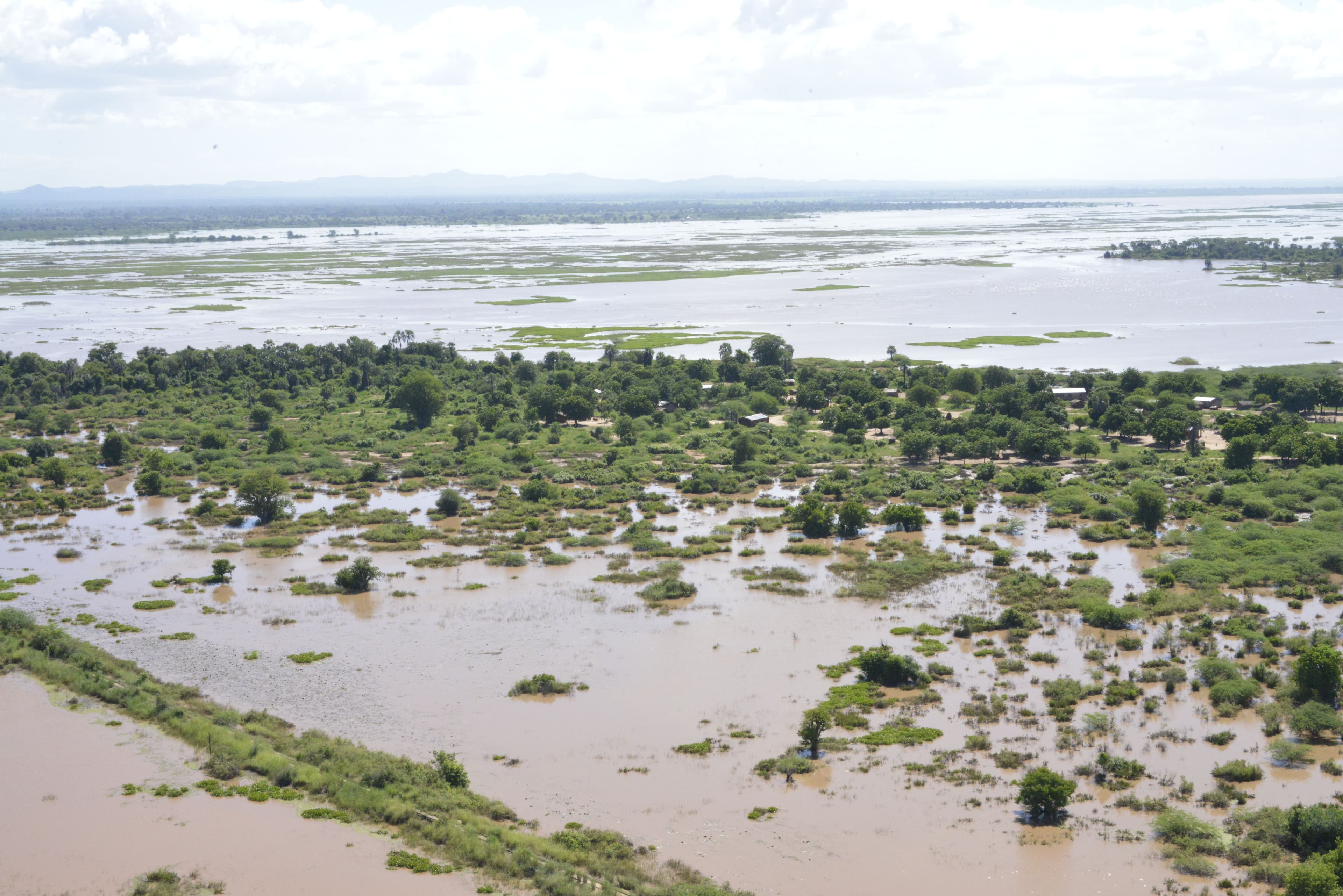
2. Nature-Based Solutions
Preserving wetlands and floodplains, not developing them, provides natural flood storage. Restoring degraded catchments reduces runoff and sediment flow.
3. Climate-Informed Design
Infrastructure (culverts, bridges, drainage) must be designed for future climate conditions, not just historical rainfall patterns. This means using downscaled climate projections in engineering calculations.
4. Early Warning Systems
Community-based early warning, linked to rainfall monitoring and flood forecasts, saves lives by providing time for evacuation and asset protection.
5. Land Use Regulation
Enforcing building codes, restricting development in high-risk zones, and upgrading informal settlements reduces future exposure.
The Role of Spatial Data
None of this is possible without accurate spatial data. You can't plan drainage if you don't know the terrain. You can't model floods without elevation data. You can't enforce building codes if you can't map where people are building.
This is where geospatial technology – LiDAR, satellite imagery, GIS analysis – becomes not just useful, but essential. It provides the evidence base for resilience investments, ensuring limited resources go where they'll have the greatest impact.
Moving Forward
Malawi has committed to climate-resilient development through its National Adaptation Plan and participation in global climate initiatives. The challenge now is translating policy into action on the ground – in city master plans, infrastructure projects, and community preparedness programs.
The data exists. The technology is available. What's needed is the political will to prioritize long-term resilience over short-term expediency.
Ascend Spatial Labs partners with government, NGOs, and development agencies to deliver the spatial data and analysis underpinning flood-resilient planning. Let's build cities that protect their most vulnerable residents.
Image Source: https://www.undp.org/malawi/press-releases/undp-supports-early-recovery-after-severe-flooding-malawi
