
For decades, the narrative around Africa’s energy deficit has focused on generation capacity. Yet, as the continent races to bridge the power gap, a new challenge has emerged: project prepareness. Too many renewable energy projects—solar, hydro, wind, and transmission—stall in the feasibility stage, not because the resources aren’t there, but because the data to prove bankability is missing.
At Ascend Spatial Labs, we see spatial intelligence as the critical link between ambitious energy goals and concrete, funded infrastructure. Here is how rigorous geospatial data is de-risking energy investments across the SADC region.
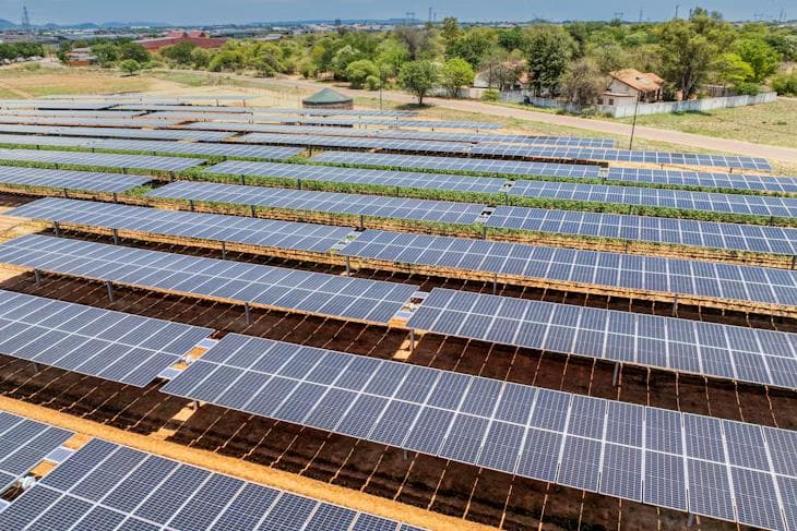
1. Beyond Irradiance: Precision Site Selection
Solar maps tell us where the sun shines, but they don't tell us where to build. Developing a utility-scale solar farm requires more than just irradiance data. It requires analyzing slope stability, hydrological risks (flood modeling), land cover, and proximity to existing grid infrastructure.
Using multi-criteria GIS analysis, we help developers identify sites that aren't just resource-rich but also constructible and compliant. This reduces the risk of unforeseen costs during the civil works phase, which can kill a project's ROI.
2. Optimizing Transmission Corridors with LiDAR
The greatest bottleneck in African energy isn't generation; it's transmission. routing a power line through complex terrain, protected forests, and community settlements is a logistical minefield.
Airborne LiDAR (Light Detection and Ranging) allows us to survey hundreds of kilometers of potential corridors in days, penetrating dense vegetation to reveal the true ground topology. This enables engineers to optimize tower placement, minimize cut-and-fill volumes, and avoid environmental hotspots before boots hit the ground. The result? Faster route approval and lower construction costs.
3. Hydrological Assurance for Hydro Power
Climate change has made hydrological baselines unreliable. For run-of-river hydro projects, historic rainfall data is no longer enough. We integrate downscaled climate models with high-resolution catchment analysis to model future flow scenarios.
This gives investors confidence that an asset built today will remain viable in the climate of 2050, turning climate risk from a deal-breaker into a manageable, quantified variable.
4. Operational Excellence through Digital Twins
Once built, assets must be maintained. Drone inspections creating "digital twins" of infrastructure allow for predictive maintenance. We can detect micro-cracks in solar panels, vegetation encroachment on power lines, or structural shifts in dam walls with millimeter precision.
This shift from reactive to proactive maintenance creates operational data trails that insurers and investors demand, lowering the cost of capital for future expansions.
The Path to Data Sovereignty
Ultimately, building Africa's energy future requires African data sovereignty. We cannot rely solely on coarse global datasets. By generating our own high-fidelity spatial data, we empower governments and local developers to negotiate from a position of knowledge, ensuring that projects serve the long-term needs of our communities.
Spatial intelligence isn't just a technical tool; it's a financial instrument. It turns uncertainty into clear, bankable risk profiles, unlocking the capital needed to power Africa's future.
Image Source: https://www.iea.org/reports/clean-energy-investment-for-development-in-africa
